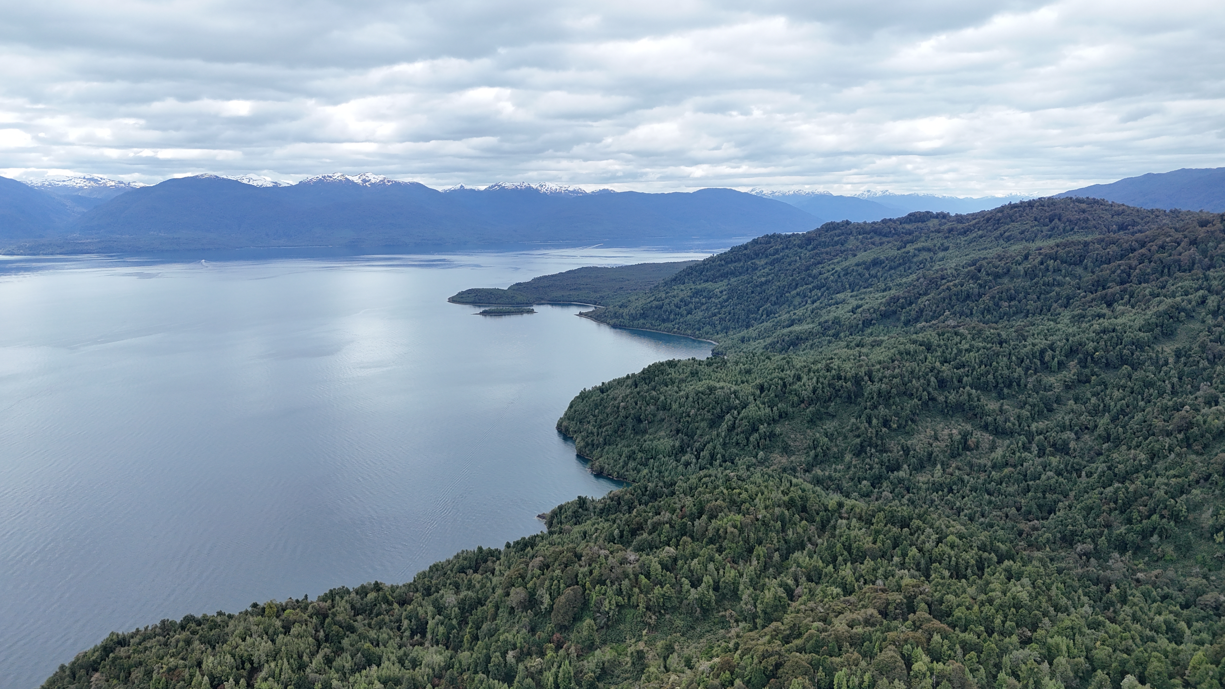
We offer advanced services in remote sensing and geographic information systems (GIS), focused on delivering precise environmental analysis and innovative solutions that enhance land planning and management.
We process and structure satellite databases with thousands of records, to provide you with clean, organized data ready to be integrated directly into your projects.
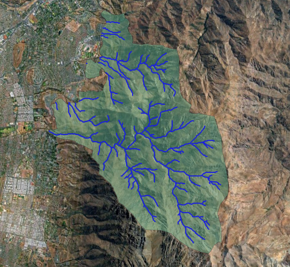
We produce professional thematic cartography and structured geographic databases. Spatial processing and analysis to answer complex questions about the territory.

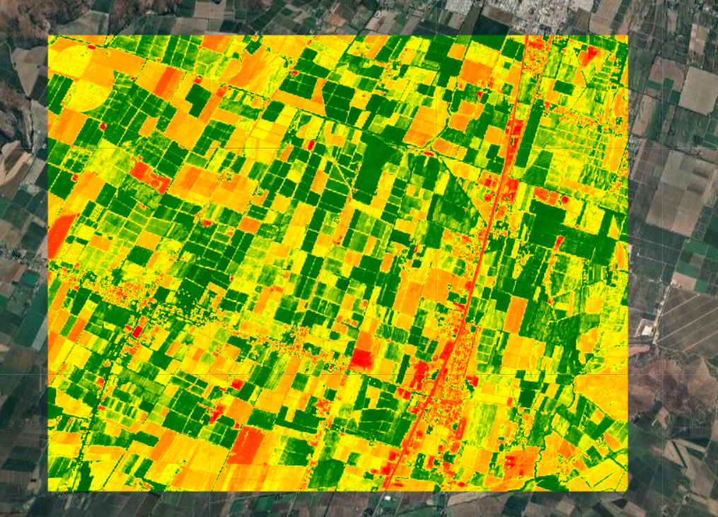
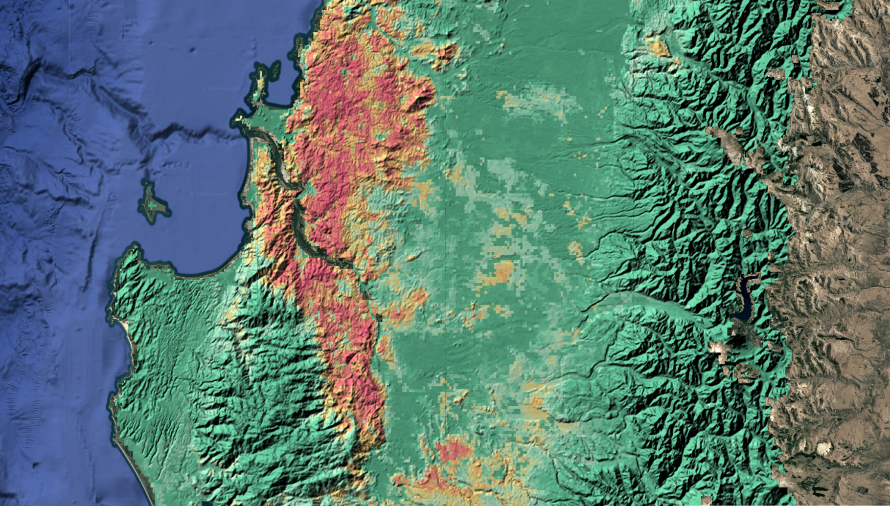
Quantify vegetation health, water and snow presence, and fire severity using indices derived from multispectral satellite imagery.
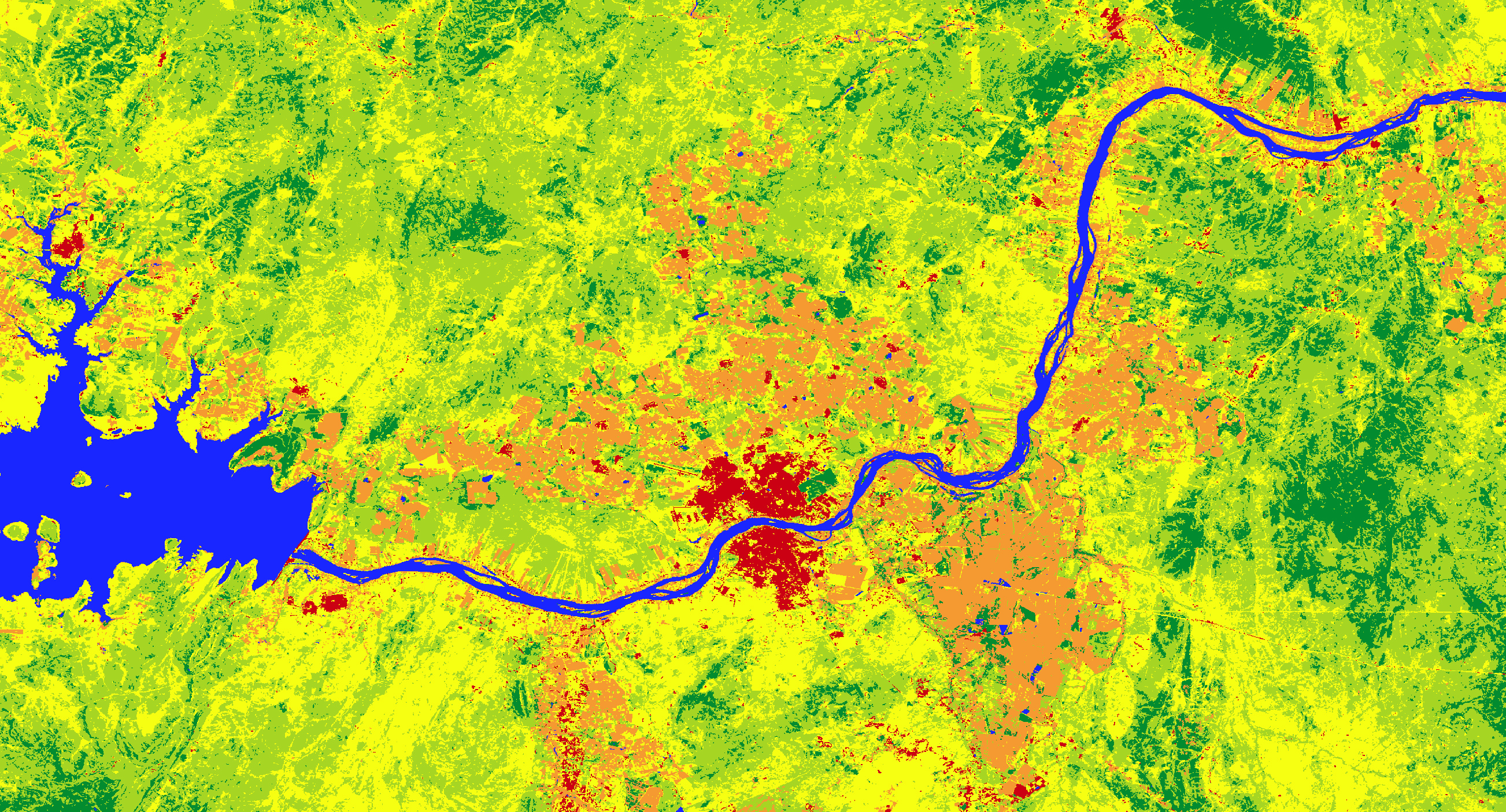
Classify the territory into land use and land cover categories. Detect historical changes and analyze landscape dynamics to understand how your study area evolves.
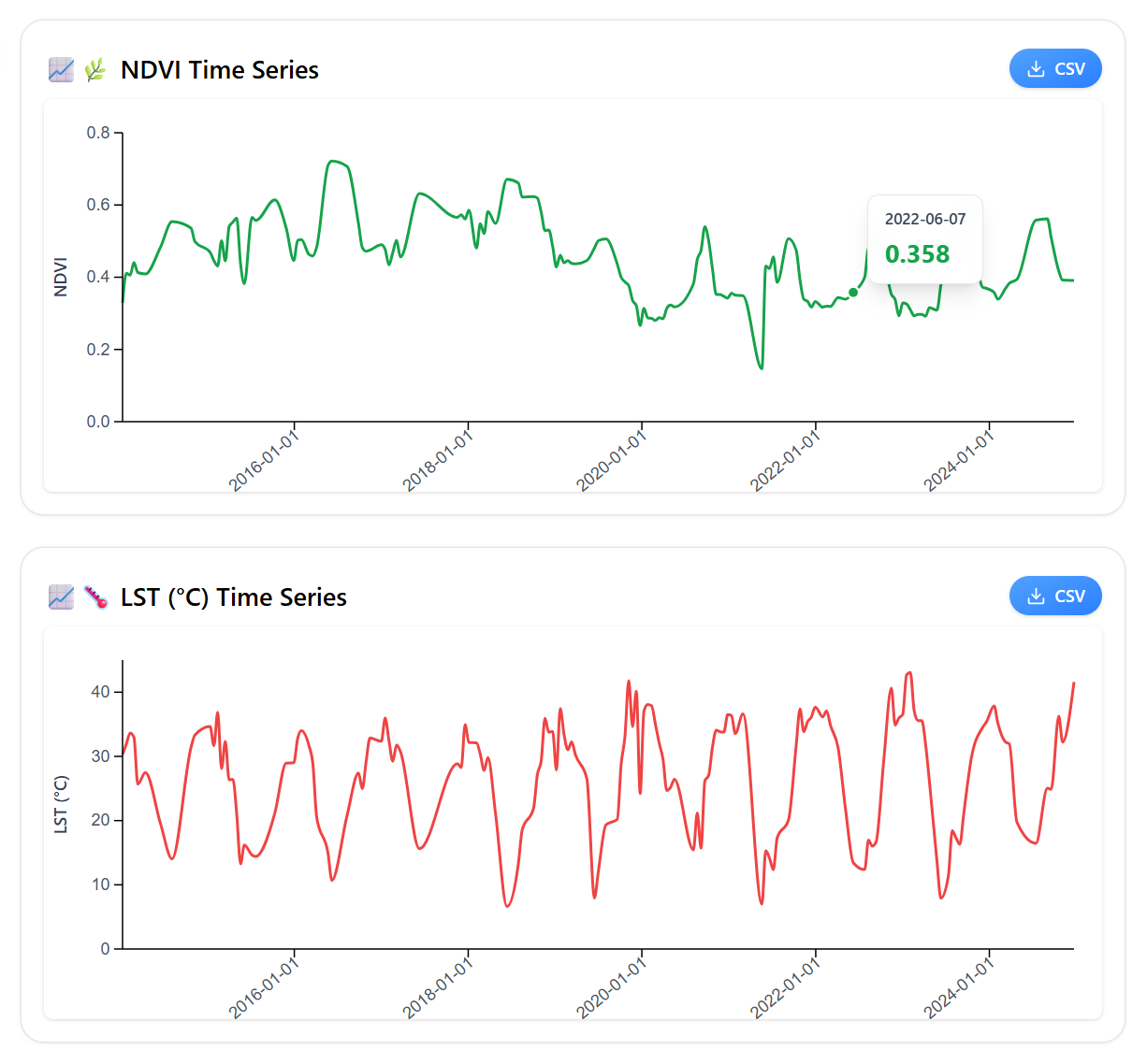
Analyze how the territory evolves over time. Spectral index time series to detect trends, anomalies and seasonal changes.
We process thousands of satellite images with Google Earth Engine to extract clean, organized data ready to be integrated directly into your research or consulting projects.
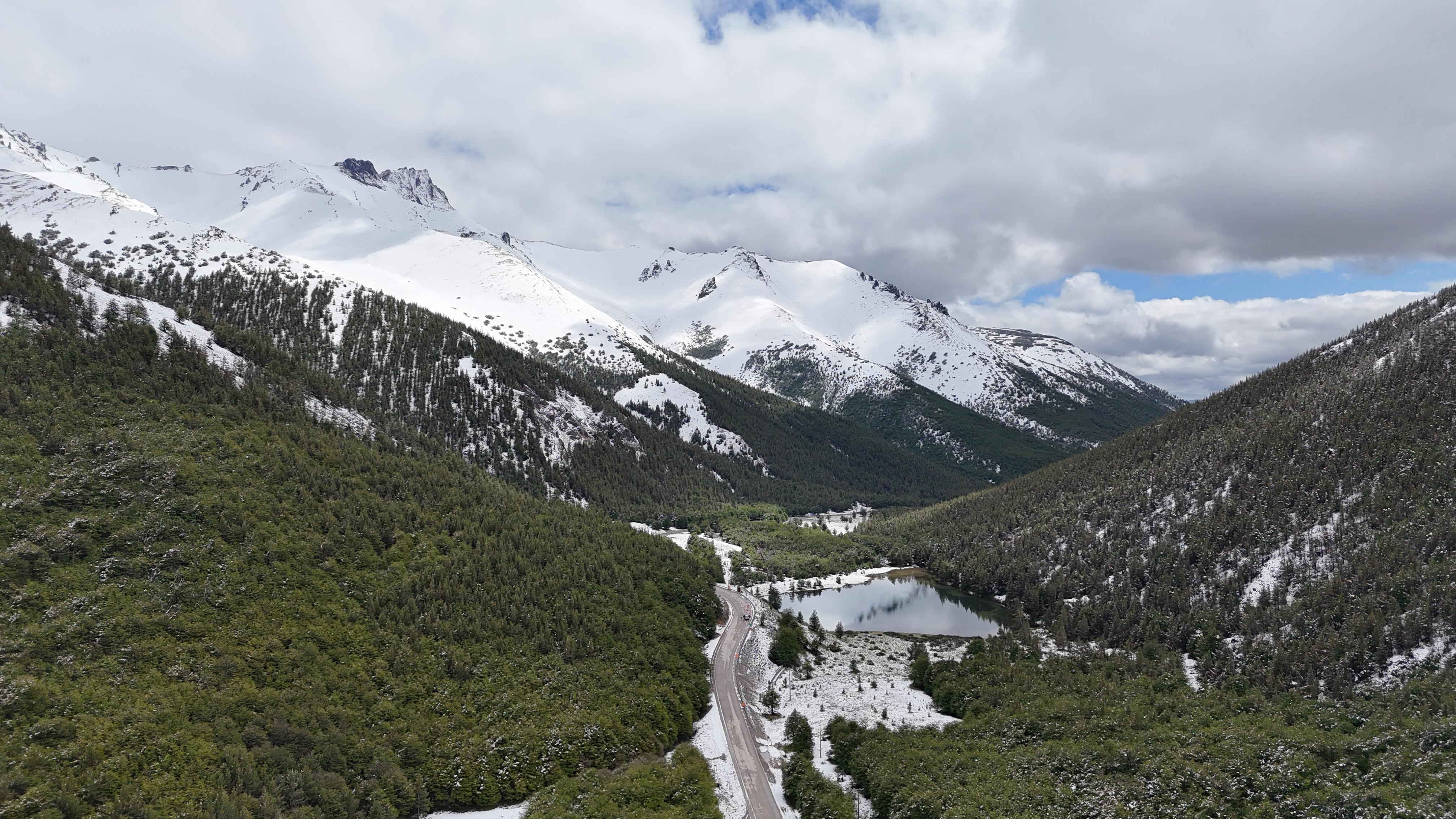
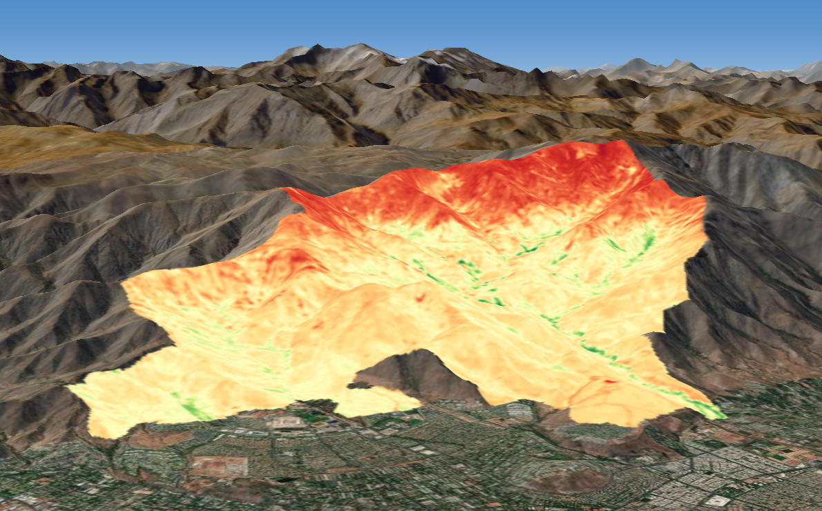
Digital elevation models and three-dimensional representations of environmental variables. Visualize terrain, vegetation cover and other geospatial data in 3D.
Let's talk about your territory and design together the geospatial analysis your project needs.
Get a quote for your satellite analysis